
Mt. Swansea – Invermere
In 1924, Mt. Swansea was established as a B.C. Forest Service lookout. A lookout structure was constructed in 1952 and removed in 1992. Follow this “Out of the Past” link to find out why this mountain is called Mt. Swansea.
Mt. Swansea is also the host of one of the longest running hang gliding and paragliding events in North America, called the www.LakesideEvent.com
Site Info
- 1,727m (5665 feet)
- N50 30.487 W115 57.209
- Host for the Lakeside Event since 1976
- Popular X-Country start point for Sailplanes
- See Maps and more info at Paragliding Earth
- Only members of the Columbia Valley Hang Gliding and Paragliding Society can fly/land here. Make sure to sign up here!
Flying at Mt. Swansea
- The Invermere Airport is 2 miles NW from the Summit of Mt. Swansea. See the aircraft approach and circuits of the Invermere Airport in the map below.
- We do advise to fly with a Aircraft radio (Frequency 123.20) to monitor and or communicate with the local air traffic. This airport can be very busy with regular air traffic, glider activity and helicopter traffic for forestry work, Search & Rescue and firefighting.
- Launches
- Northwest launch
allows about 3 wings to set up and is ideal for afternoon and evening flights. - South launch
allows about 2 wings to set up and works mainly in the mornings.
There is also a narrow metal ramp for Hang Gliders.
- Northwest launch
- Landing
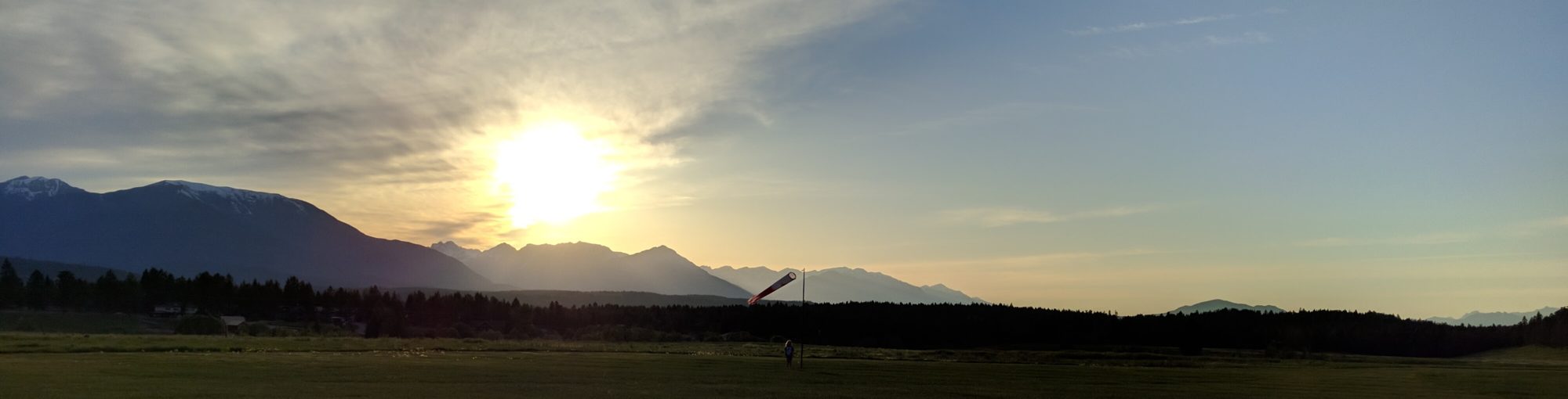
- The map below shows the the aircraft approach for the Invermere Airport.
Note, the air traffic approaching from the south are flying close to our takeoff site and right over our landing site. - P2/H2 pilots can only land at the designated landing field at Swansea Loop Road.
Zoom in at the map below to see details and suggested landing approaches.
- The map below shows the the aircraft approach for the Invermere Airport.
Access – Landing site
The google street/maps view below shows you the location of the ladning field, which is beside the Windermere Water & Sewer Company utility company.
We can park at the parking area next to the field and should not park along the building.
There is no overnight parking and this site should be left after landing.
Member
Access – Mt. Swansea
From the Invermere Turnoff on Hwy 93/95 travel south approx. 2.7 km to Windermere Loop Road. Turn left and cross Swansea Road. Travel 3.2 km where a left turn will take you over the Westroc Gypsum Mine Haul Road onto the signed Mt. Swansea Forest Service Road. Note that the paved Westroc Road is closed to public traffic and you must give right-of-way to industrial vehicles. After 5 km the steep Mt. Swansea Road terminates at the upper parking area and trailhead. The road is graded to accommodate high clearance 2WD vehicles. However, extreme caution must be used, especially in passing oncoming traffic since the road is very narrow with numerous switchbacks. Drive carefully with headlights on.
From the parking area this short steep trail leads to the summit of Mt. Swansea – a hike of 15 minutes. The one-half (.5) kilometer trail gains 105m in elevation and leads to exhilarating panoramic views of the Columbia Valley lying almost 1000 meter below the summit.
NOTE: A minimum of a P2/H2 rating and a membership with the Columbia Valley Hang Gliding & Paragliding Society and the HPAC are required to fly at Mt. Swansea.
Register here.


Projects
2020 – New Wind-meter
First of all a big thank you to Jan, Kris and Max who maintained the 2013 wind-meter over the years.
The Society followed the suggestion from Toby Stier to use a wind-meter which is used at other flying sites to be uniform and on the same map and use this new technology which requires next to no maintenance.
Thanks Toby to make this all happen!
2013 Wind meter, Webcam and launch site improvements
Project funded by:
- Recreation Sites and Trails BC
- BCHPA
- Columbia Basin Trust (25% of whole project)
- Western Economic Diversification Canada (50% of whole project)
With the help of Columbia Valley Cycling Society, Valley Chamber of Commerce, Ministry of Forests, Lands and Natural Resource Operations (Aina Cernenoks),lot of volunteer time of the local pilots, Lake Windermere Pointe (Webcam tower) and M & H Logging (for groundwork). Recognition for assistance is also due to District of Invermere, Regional District of East Kootenay